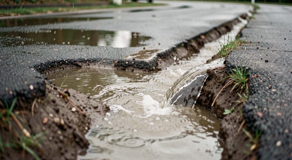
Every other job on a track is undone by water going where it was not planned to go. A berm built in layers still fails if runoff crosses it. A grooming schedule is meaningless in a spot that is saturated for four days after every storm. Drainage is the one piece of track work where published criteria exist, written by people whose job is moving water off bare ground, and they are worth reading before a shovel comes out.
Two standards, and what they are for
The Natural Resources Conservation Service publishes conservation practice standards, each a short document with a definition, a purpose and a set of criteria. Two of them are directly useful here. A diversion, code 362, is defined as a channel usually constructed across the slope with a supporting ridge on the lower side, used to intercept surface and shallow subsurface flow and to divert water away from things you want to protect. A grassed waterway, code 412, is defined as a shaped or graded channel established with suitable vegetation to convey surface water at a nonerosive velocity, using a broad and shallow cross section, to a stable outlet.
Between them they describe the two things a track needs: something that stops water arriving, and something that carries away the water that does. Neither standard was written with motocross in mind. They are agricultural and conservation criteria about runoff, which is exactly the problem, and quoting them is not engineering.
Both standards also stop where the track's own ground stops. Water carried off a property still has to travel through ditches, culverts and buried pipe, and that is household drainage rather than track work: roots finding an old seam, a line that can be lined or burst instead of dug up, and the point where the job stops being yours. The drainage and sewer guides at Malandracia take up that side of water, in the same plain, name-the-standard style.
The numbers those standards give
| Item | Criterion | Standard |
|---|---|---|
| Design storm, temporary diversion | Peak discharge of the 2 year frequency, 24 hour duration storm | 362 |
| Design storm, protecting agricultural land | 10 year frequency, 24 hour duration storm | 362 |
| Design storm, protecting buildings and roads | Not less than a 25 year, 24 hour storm, with a minimum freeboard of 0.3 feet | 362 |
| Design storm, grassed waterway | Peak runoff expected from the 10 year, 24 hour storm | 412 |
| Ridge top width | Minimum 3 feet where a supporting ridge is required | 362 |
| Steepest ridge side slope | 2:1 for nonfarmable slopes, unless site specific soil analysis shows steeper is stable | 362 |
| Waterway side slopes | Flatter than 2 horizontal to 1 vertical | 412 |
| Outlet | Every diversion must have a safe and stable outlet | 362 |
The last line is the one that gets ignored on private properties, and it is the one that causes the most damage. A diversion without a stable outlet does not remove a problem, it relocates and concentrates it, which is how a modest wet patch becomes a gully in one season.
How do you find your own design storm?
A ten year, twenty four hour storm is not a fixed quantity of rain. It is a local statistic, and the depth of it in inches differs sharply from one part of the country to another. NOAA publishes precipitation frequency estimates through the Hydrometeorological Design Studies Center, where you can enter a location and read off the depth for a given return period and duration.
That number is the input everything else hangs on. Without it, a swale is sized by eye and by the memory of the last storm, which is a sample of one. With it, you at least know whether the channel you cut is meant to handle two inches in a day or six.
What should you build first on a small track?
- Find where the water arrives from. Walk the property during or just after a storm and follow the flow uphill. Most track water is not rain that fell on the track, it is rain that fell above it.
- Intercept it before the track, not on it. That is precisely what a diversion is for: a channel across the slope with a ridge on the lower side.
- Give it somewhere to go. A vegetated channel with side slopes flatter than 2:1 that runs at a nonerosive velocity to a stable point. Grass is doing structural work there, not decoration.
- Only then deal with the low spots on the track itself. Many of them stop being wet once the water from above stops arriving.
The order that saves the most work
Intercept above, convey around, and only then regrade the track. Regrading first means doing it again after the next storm.
Reading the result
A drainage fix is judged after rain, not after the work. The signs that it is working are that the standing water is gone within hours rather than days, that no new channel has cut itself across the surface, and that the vegetated waterway shows flow but not bare soil. The signs it has failed are a fresh gully, a deposit of fine material fanned out where the outlet is, or a new wet spot below where the old one was.
The morning read that tells you what happened overnight is described in reading track conditions, and the low points worth checking on foot are the fifth stop of the walk in how to read a track. What follows a wet week, once the water has gone, is the work in grooming a track.
Sources checked for this note
The definitions, design storm frequencies, freeboard, ridge top width and side slope ratios are quoted from the United States Department of Agriculture, Natural Resources Conservation Service: Conservation Practice Standard 362, Diversion, print date March 2022, and Conservation Practice Standard 412, Grassed Waterway, print date September 2020, both checked September 5, 2026. Local precipitation frequency estimates come from the NOAA National Weather Service Precipitation Frequency Data Server, checked the same day. These are conservation criteria for runoff on farmland, not a standard for motocross tracks, and quoting them here is not a design service.